


Introduction
Scientists call both the inhabited area and the wider world "Yen", the Go word for ground, though it has many other names in many languages. The Yen land is a lone continent or rather a continental shelf that is surrounded by the Umi, the world ocean. Parts of the land rise high into the sky, while others are submerged in shallow seas. In various place it takes the form of islands, some large, some small. As far as the people of Yen know, their world is flat and may stretch infinite wide. The continent is the only place where the earth rises above sea level. Some explorers have sailed away to try to discover new lands beyond the range of sight. Most did not return; none have reported success. Because of the roughness of the water, there is little sea traffic; land traffic is equally cumbersome. As a result many regions have developed and retained their own distinct character.
Map
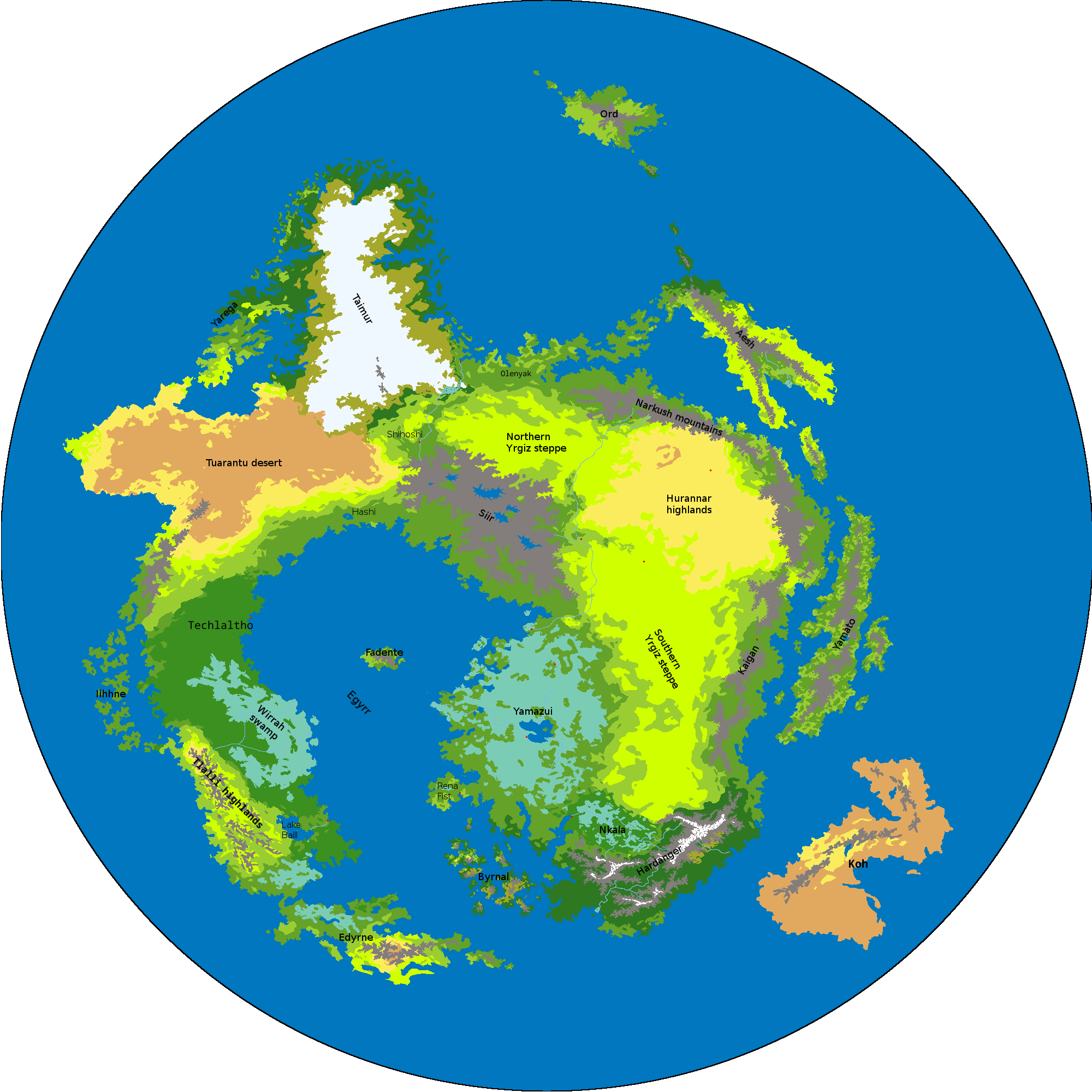
The map to the right has a diameter of 3000 km (7.5% of the diameter of Earth) and a surface of 28,250,000 km² (5.5% of Earth, slightly smaller than Africa). About 35% of this (roughly 10,000,000 km², about the size of Canada on Earth) is land. Only the Yen continent and its islands and the part of the Umi that is its immediate area are shown; the full Yen world is infinitely larger. Open the map in a new window or download it and open it in an image viewer to zoom in. Each pixel is 1.5 x 1.5 kilometers in size. Major towns and cities are shown on the map, lesser ones not. Settlements are not nearly as large as they appear on the map (20x20 km!) and neither are the rivers as wide.
Legenda:
| mountains | |
| ice | |
| tundra | |
| taiga | |
| jungle | |
| forest | |
| woodland | |
| steppe | |
| scrub | |
| desert | |
| wetlands | |
| river | |
| sea / lake |
The terrain types listed above are not absolutes.
Mountains are barren rock in some places but covered with meadow or trees in others;
taiga, jungle and forest all denote rather dense forest, but of different types;
woodland is used as a label for open woodland, 'half forest', regardless of type;
et cetera.
Only the largest rivers are shown on the map; there are many more smaller streams.
The major cities are mentioned in the descriptions below but not shown on the map.
Lesser towns, villages, hamlets, temples, castles and other settlements are not mentioned at all.
Regions
Aesh
Byrnal
Edyrne
Egyrr
Fadente
Hardanger
Hashi
Hurannar highlands
Iihhne
Kaigan
Koh
Narkush mountains
Nkala
Olenyak
Ord
Rena Fist
Shihoshi
Siir
Taimur
Techlaltho
Tlallii highlands
Tuarantu desert
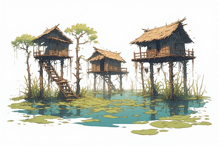
Wirrah swamp
Yamato
Yamazui
Yarega
Yrgiz steppe
Aesh
Description
Aesh is an island that lies in the northeast. It is about 65,000 km² in size. Earth flows have pushed it out of the sea, but they have partially subsided. The temperature is average and the rainfall, despite Aesh being an island, meager. Large parts east and west of the central mountains are grassy plains. These are is the birthplace of the thref, who still rule the island. The north and the Fnjall valley to the southeast are more forested. The main drain of the latter is the Fnjall river.
People
Aesh is home to some 4 to 5 million thref, who roam its west and east plains in vast herds. Most are found in the east and west; fewer in the southeastern woodlands surrounding the Fnjall valley; very few in the northern taiga and the central mountains. For food, they graze the grassy plains, but they supplement their diet with vegetables, fruit and nuts, mostly from Aesh itself.
Settlements
Originally thref wandered the plains as nomads.
It was the simi who taught them how to build homes.
Their tentacles are dextrous but not strong, so they limit themselves to small, flimsy structures.
These are temporary shelters and workshops, not true homes.
These huts are not grouped together in large settlements, but scattered all over the land.
Large groups of thref are found in temporary gatherings.
There are dozens of large settlements and hundreds of smaller ones spread over Aesh,
traditional meeting places that hold thref memories.
There are but few more huts there than in other places.
The port of Thr is located at the southwestern tip of Aesh.
This is the main link with the mainland, only 30 kilometers away.
Culture
Thref are grazers, moving from one patch of fertile grassland to the next.
The love the freedom of their existence and care little of the headships of cold, heat, drought or heavy rain, though occasionally seek shelter.
Their primary pastimes is dancing.
They produce music through singing and stamping and dance singly, in triplets or in large numbers.
Through intelligence and cooperation thref have long ago exterminated all large predators on Aesh.
But without hunting by these predators they run the risk of overpopulation, even with their low birthrate.
Therefore, they have strict rules on how many children each triplet is allowed to bring into the world.
Politics
Thref decide on political matters in periodic meetings. Unlike on Earth, where decisions are often decided with a yeas or a no, thref tradition demands that all matters must be condensed into not two but three possible outcomes. There can be a lot of debate on which outcomes will be voted on, but sooner a or later the partition is decided. Then each thref triplet chooses an outcome and votes for it, so the process is democratic. Sometimes a single outcome prevails over the other two; at other times two combine to possibly outvote the third. There are no political parties or rulers among the thref, all are equal.
Economy
The Thref of Aesh do but little trading with the rest of Yen. They export some honey, produced by their very large Elli bees, and mead, and import various metals. Most of their trade is handled by simi sailing ships. A few yokani are allowed to mine marble in the central mountains, which is the finest on Yen and their second major export, despite the difficulty of getting the stone blocks accross the sea.
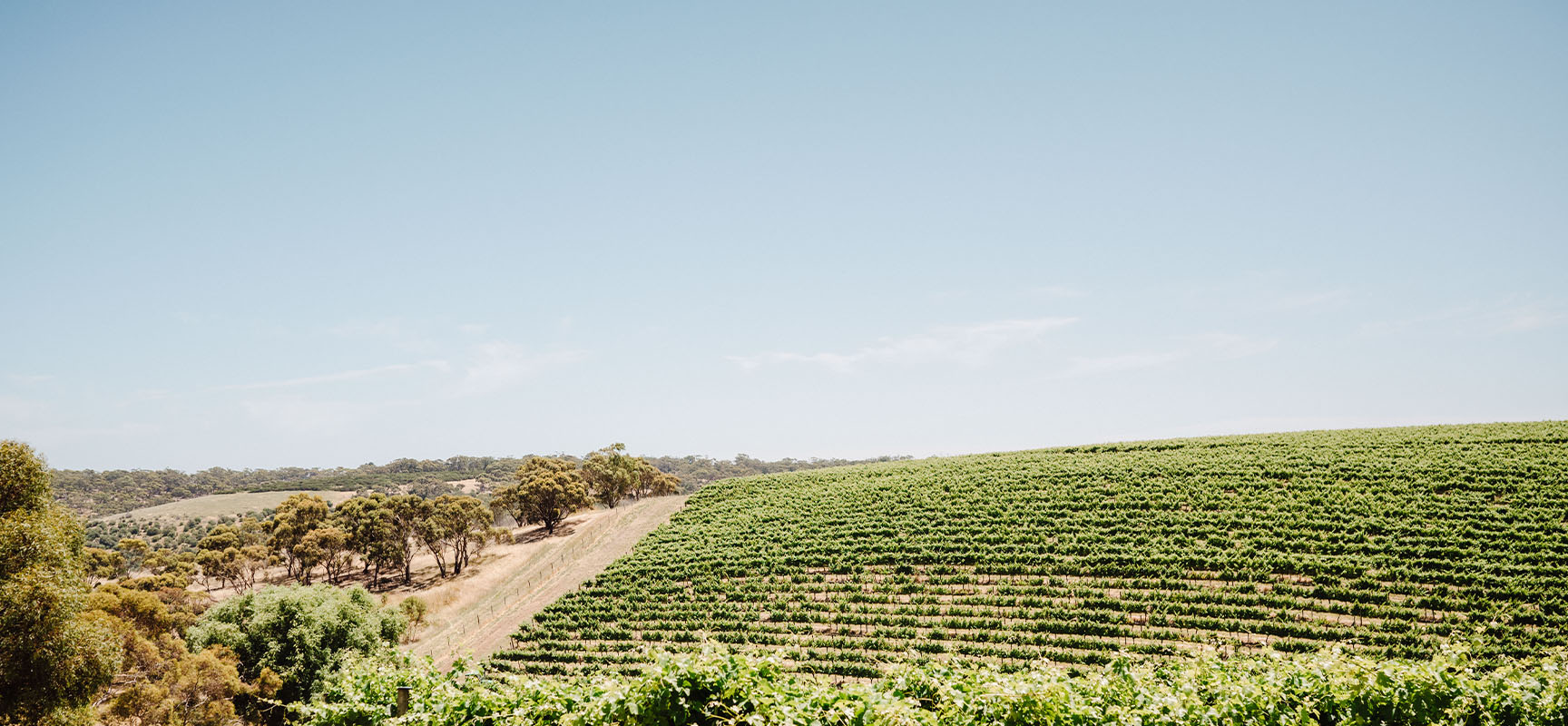
Byrnal
Description
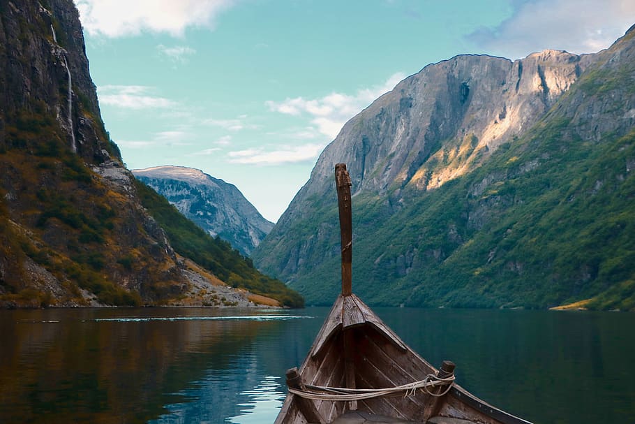
Byrnal is an archipelago in the south. In the past, a brief but violent period of high volcanic activity pushed it up from the sea, but since then the gold has moved to neighboring waters. The temperature of the region is now below average, rainfall is plentiful. Today boreal forest covers the islands. Erosion has not had much time to soften Byrnal's sharp peaks, which stick out of the sea as the sharp teeth of a predator. Water evaporating from the surrounding seas collides with Byrnals' high mountains and condenses to provide a constant influx of rain and snow. Glaciers and rivers have carved deep valleys and fjords into the earth and created a landscape of jagged mountain ranges with a few fertile strips of lowland in between and countless small islands at the edges.
People
Byrnal was colonized by tarhar from the mainland long ago. In response to the harsh climate they have become bigger and more muscular than their northern counterparts. The mountain and water barriers have prevented its political unification and all chiefdoms fiercely guard their independence. The limited resources of the land has forced the Byrnall to supplement their income by fishing, trade and raiding. They are one of the few peoples who dare to sail out into the open sea. Yen knows them as explorers and traders, but mostly as raiders. There are around 10,000 - 15,000 Byrnall, concentrated in the valleys that are surrounded by boreal forest and tundra. Total population density is low, somewhere around 0.5 - 0.6 people / km².
Settlements
No Byrnal settlement is larger than a village. Some of these a nestled in fjords and bays, others are higher up, with strong fortifications enhancing natural cliffs. Here and there are hamlets and individual houses. Most are permanent homes, some are temporary shelters.
Culture
The Byrnall discern two different, complementary cultures among themselves.
There are the "sepmala", reindeer herders who occupy the inner regions of the islands,
and the "irker", seafarers who live at the coasts.
The sepmala are seen the carriers of culture, including many artists, poets and priests,
while the irker are fishermen, traders, raiders and explorers.
The two mix and mingle frequently and see themselves as a single people.
The Byrnall may be compared to Earth vikings.
There are both similarities and differences.
They carve runes, build ship graves, have feast halls and field berserkers in battle.
Yet they practice almost no agriculture, drink sake instead of mead and employ only a few slaves.
The local religion is not polytheistic but animistic:
the people worship the Byrnal titans, basically the islands themselves, not gods with human personalities and they have no Ragnarök.
Like among the vikings, words and language are serious business in Byrnal, even more than on Earth.
Poetry is regarded a high art, not only for the leaders but also among the common people.
The Byrnall love to set stories in wood and stone to make them 'last' forever, or at least a very long time.
Blessings and curses are taken very seriously; a wrong word can spell disaster.
Maybe as a result of this, the Byrnall way of speaking is subdued, they frequently make understatements.
Politics
The Byrnall are organized in clans.
Most clans rule one island and a few islets, while the largest are home to two or three clans.
Each clan is headed by a leader, usually a powerful warlord.
Sometimes a woman manages to seize a throne.
Succession is by seniority, i.e. the eldest relative,
though an unsuitable successor is often murdered or otherwise sidelined to make way for a stronger candidate.
Succession pains, divided loyalties and insults often lead to feuds that can last long and sometimes erupt into full scale wars.
Often peace is made by exchanging gifts and marriages, but the latter can spur intrigue and give rise to new conflicts.
Only when the islands are threatened by foreign invasion do the tribes unite to fight the common enemy.
Even then rivalries and grudges can easily tear the union apart.
Economy
The sparsely populated Byrnal islands produce little more than marine products. Its fishermen harvest ambergris, shells and of course fish, some of which is salted and exported. A few brave sailors venture out into the southern Umi and hunt narwhals, walruses and whales for their ivory. The Byrnall supplement their exports with beachcombing and especially raiding the nearby coasts to the north and east, but also beyond.
Edyrne
Description
This peninsula lies in the extreme southwest, linked to mainland Yen by a narrow land bridge. Its terrain is varied, wet and swampy in the northwest; dry, down to desert level, in the southeast; again wetter in the far east. The temperature distribution is more even, somewhat warmer than average. It is like both the area and its inhabitants want to remain separated from the others; Edyrne is dominated by a wide range of flora and fauna that have developed poison as their primary weapon, both as offense and defense. From the tiniest gnat to the largest herbivore, almost all use some kind of poison and are resistant to several others. They wield blood poisons, contact poison, respiratory poison and more. Intruders from other areas usually last no longer than minutes. Fortunately for some strange reason the horde of poisonous creatures does not venture beyond their native island, except for the pn'umnaimen, the only intelligent species.
People
Nobody knows how many pn'umnaimen make Edyrne their home. Sages have pondered their small size and predatory lifestyle and have come up with a wide range of figures that range from as few as 1,000 to as many as 200,000. The most realistic number seems to fall between 10,000 and 50,000.
Settlements
The pn'umnaimen like underground lairs because of the more even temperatures there. Natural caves are used and also burrows. It is rumored that they employ pangolins as slaves to dig tunnels for them. Some explorers have guessed that these can grow to town-size.
Culture
Competition is at the heart of pn'umnaimen culture.
They like to play games, some of which are just for fun, while others are deadly serious, or something in between.
Much of these games concern hunting or being hunted, among the pn'umnaimen themselves or including other species of Edyrne.
A popular way to hone one's skills and gain the respect of peers is to go abroad and act as spy, assassin puruse another dangerous occupation.
Many pn'umnaimen, who are generally despised or even hated in other parts of Yen, perish there,
but some make it back to the islands carrying a load of stories about their exploits.
The pn'umnaimen have some secret way of verifying the veracity of these stories; liars are killed.
Politics
Economy, military and statehood on Edyrne are all small scale and underdeveloped, so there simply is not much politics on the island. On a local scale there is some hierarchy. The most able and proven pn'umnaimen dominate the others, but hey have to defend their position frequently.
Economy
No sane person sets foot on poison-infested Eydrne. There is no industry or trade here. The island's only public export is its single intelligent species, the pn'umnaimen, who act as spies and assassins abroad. However, there are reports of traders obtaining various types of poison in exchange form slaves and luxury goods. Also, it is the only place where rune purple, an extremely costly dye, can be obtained.
Egyrr
Description
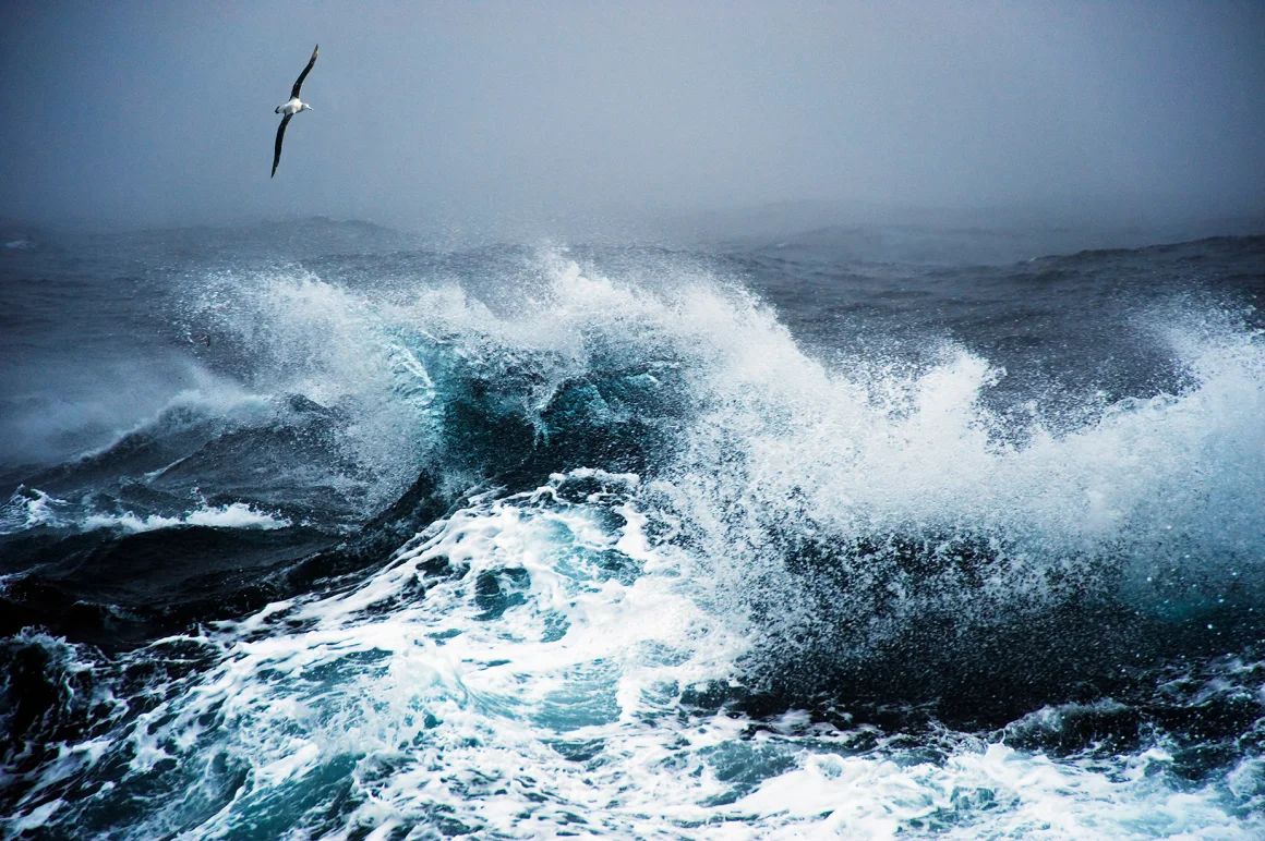
The Egyrr is the inner sea of Yen, almost completely enclosed by the arms of the continent. It is about 1500 kilometers wide and 2500 kilometers long, somewhat larger than the Mediterranean on Earth. The Egyrr is shallower than the Umi with much tamer waters, though still rough by Earth standards. It takes good ships, excellent sailors and a bit of luck to travel across it without sinking.
Fadente
Description
Fadente is a lone island located more or less in the center of Yen, only about 4,000 km² in size. A large volcano, the Erka, provides some gold and silver. The island has average temperature and rainfall. Though surrounded by stormy seas, Fadente is halfway the eastern and western wings of Yen and thus a natural stop for almost all seafarers. The island is coveted by many powers, but the inhabitants deploy a strong navy and have turned the slopes of the Erka into a giant fortress, so it is a hard nut to crack. From their stronghold they sail all over the Egyrr, rivaling the Byrnall in seamanship.
People
The island is home to 30,000 simi and some tarhar.
Settlements
The capital and main port of Fadente is Barberuzzo, located in the east at Tirre Bay. Its harbor is the best on all the island, sheltering many ships during the storms that are frequent on the Egyrr. West of the town stands the Barberuzzo lighthouse on Monte Trasacco, where a large fire is always kept burning.
Culture
Many people of Fadente are mariners, either fishermen or traders.
They pride themselves on being the best sailors of Yen, though others lay claim to that title too.
The islanders travel far and wide, but sooner or later always return to their native Fadente; the sense of being a nation is strong here.
Youngsters are encouraged to go on at least one sea journey to widen their view and gain the respect of older people.
Those who don't are often considered second rate citizens, though there is no formal honor attached to sea travel.
The people of Fadente feel a kinship with other speakers of Lingatio: the merchants of Hashi; Seidato and its environment; the Rena Fist.
A substantial number traders earn a lot of money in their trade.
They invest it in the temples and their afterlives, as taka-nairukyō is the main religion here.
As a result, there are many grand temples on the island, built in marble and decorated with copper and paintings, all imported.
Politics
Fadente is a plutocratic republic, ruled by the "jolin", a kind of senate, which acts as legislative body and also supplies senior administrators.
The island is divided into districts.
Each district elects its senator, usually a wealthy and influential merchant.
Such a senator is in office for a period of 3 to 9 years, or until he/she dies.
Both the length of the period of the election dat vary from district to district, making the composition of the senate changing all the time.
From among their numbers the senators elect ministers and the "shube", the first among them.
Ministers act as executive officials.
They are in office for three years, or again until they die.
Because several ministers have died while in office, the election dates for each office, which originally were all the same,
have become unaligned like the elections of all senators.
Economy
The island of Fadente is the main stopover for naval traders who dare cross the Egyrr, many of whom are from Fadente itself. The lords of the island tax this trade and have grown rich on it. Islanders also scour the Egyrr for marine products. Most fish is consumed locally, but ambergris, sponges and shells are exported, while pearls mean instant wealth. On the island itself flax, soybeans and wheat are grown.
Hardanger
Description
The Hardanger is a mountain range that is composed of hard rock that has withstood erosion quite well, making it almost as high as the Taimur highlands.
Rainfall is average in the region.
Low amounts of gold, but also simply their height, cover the tops of these peaks in snow; the valleys are home to boreal forest.
The border to nearby Nkala is one of extreme temperature change, from cold to warm.
Three large and many smaller rivers carry water from the mountains to the sea:
The Ebleth, the largest and longest, to the west through Nkala;
the Vafsna, also westward, its upper flow narrow and fast, but broad and meandering beyond the mountains;
the Gedbrand not long but with a large discharge nonetheless.
People
The area was settled by hardy tarhar who developed a distinct culture and language. They are related to the people of Byrnal.
Settlements
The largest settlements in the Hardanger mountains are villages. Many more are hamlets or single houses.
Culture
The tarhar of the mountains are tough people, physically and mentally adapted to the height and cold.
They take pride in this and consider themselves second only to their gods, the Hardanger giants, personified by the mountains themselves.
They refuse to pay homage to any other gods or ideas.
The people have a rite of passage where youngsters are kicked out of their home territory.
Outside, they must survive on their own for a week.
Many of them seek wilderness areas, because if they wander into the territory of another tribe, that group may hunt them too.
Politics
The tarhar of the Hardanger are divided into dozens of tribes, all of them fiercely independent.
In the mountains each tribe inhabits a single or a few valleys; in the taiga the territories are larger.
Each tribe is lead by a headman or -woman, who is a first among equals.
When a headman rules badly he may lose his position and even be killed.
War chiefs are usually though not always men, subordinate to the headman who takes care of civil affairs.
It is the war chiefs who lead the tribes on raids against neighbors, either in the Hardanger mountains themselves or in the lowlands.
Hardanger warriors often wield axes.
They are used to fell trees in the taiga for building materials and firewood and carry over the skill of wielding them to war axes.
Bronze and iron axes are about equally common.
Economy
The Hardanger contains the richest sources of tin on Yen, essential for the production of bronze. This is the main export of the region, though mining in the high cold mountains is difficult and hard. The mountains are also mined for granite, carnelian and iron, and obsidian plus onyx in the western half. Wool from mountain sheep too is a popular export commodity. The tarhar of the mountains import food, sake and luxury items, most it from neighboring Nkala and Kaigan.
Hashi
Description
The 'Bridge' is the strip of land at the north edge of the Egyrr sea that connects eastern and western Yen hemmed in by the Tuarantu desert in the northwest, the Siir mountains in the northeast and the Egyrr sea in the south. Hashi spans about 90,000 - 100,000 km². Temperature is above average here, rainfall average. The core of the region, the coastal strip, is heavily forested. Wekalai and Simi have fought many battles here, littering the area with forts, ruins and grave mounds.
People
Population density is remarkably low; only about half a million people live here. Most of them are simi, a few tarhar. Weka and wekalai are frequently encountered in the western half, though their numbers vary a lot.
Settlements
Miyal is the main trading port of the Siir mountains. From this busy port goods are imported and exported all over the Egyrr and even beyond. It is strategically located on a small peninsula, a natural fortress.
Culture
Nairukyō is the main religion in Hashi.
Hara-nairukyō and ju-nairukyō have a significant presence, but taka-nairukyō is the most popular.
Each town is a temple town where the elite shows off its might and wealth in grand building projects.
These stimulate architecture and art; there are many artisans and artists in Hashi, which are renowned thoughout Yen.
Hashi culture is definitely urban, the towns being like islands in a sea of green.
Agriculture and horticulture have cleared patches of the forest, yet they are kept small, also like small islands in the woods.
Like towns, they are often walled and studded with towers.
Outside the towns and fields life is dangerous, with weka and wekalai frequently infiltrating, especially in the west.
Both sides hunt each other in a never ending cat-and-mouse game.
The simi of Hashi pride themselves of being as good woodsmen as the cat peoples, though the latter turn their nose up at that.
Politics
Each town is the nucleus of an independent city-state, or rather town-state.
There is frequent warfare among these, though in times of crisis they unite against any common invader.
Towns raid each other for each other's wealth and sometimes subjugate a rival town.
Outright conquest is rare and does not last long.
The largest and most powerful state is Miyal.
Each town-state is ruled by a king, supported by ministers that he appoints and below that a small bureaucracy of professional civil servants.
The king is elected by the Debusai, the wealthiest among the citizens.
It takes significant bribery and promises of favors to be elected king,
but once in office he is king for life and can control the flow of money and power.
Kings tend to rake in much wealth to guarantee a good afterlife, as prescribed by the taka-nairukyō but if sensible do not forget their former peers either.
Only when a king badly misbehaves do the Debusai call for the Rite of Cleansing.
That means that they hire assassins to murder the king and thus make way for a new one.
Economy
The Hashi region produces silk and has the richest supply of amber on Yen, much of which is exported. It also produces wheat, rice and sake, and soybeans in the south. Dyes include true indigo, indigo from woad and kermes. The region is also a junction for both east-west and north-south trade. Its rulers tax this trade heavily, so there is a lot of smuggling being done.
Hurannar highlands
Description
The northeastern part of mainland Yen is dominated by the Hurannar highlands, an upload plateau with some low hills. The temperature is a little above average. The region receives little rainfall because silver is scarce, and it is shielded from ocean clouds by the Narkush mountains to the north and east and Siir in the west. The vegetation is mostly scrub. The highlands are about 150,000 km² in size.
People
The highlands are the birthplace of the telgu, who still dominate the highlands, despite the later arrival of simi from Yamato. Despite the aridity, some 250,000 telgu live here.
Settlements
Salsk is the largest and holiest city in the Hurannar highlands, located in its northeast. The ground underneath is stuffed with myriad catacombs, housing the mummies of countless ancestors. It also features a massive pillar with a crystal on top that catches sunlight and reflects it down on the city.
Culture
The telgu of the Hurannar highlands are a patient people, who delight in tending farms and architecture, taking years if not decades to complete a 'work'.
They often mix organic and manual construction, for instance carving a statue with plant roots or building it like an orchestrated stalagmite.
Even farmers try to make their fields into artworks, ploughing intricate patterns instead of straight grooves.
Many days every year work is interrupted by religious festivals.
Then a lot of drinking is done, as the people practice uhemet, the telgu religion.
Politics
The government of the highlands is a potocracy, i.e. rule by the biggest drinkers.
The telgu who can quaff the most beer, mead, wine and/or ghistt before passing out is the king or queen.
He or she is supported by a staff of secondary, almost biggest drinkers.
Most of this aristocracy comes from the eldest, largest and mostly wisest telgu,
but sometimes a younger one can match them and become a member of the court too.
The king and his/her court spend little time in the capital Salsk.
Instead, they travel around, collecting taxes, confirming feudal bonds and settling disputes.
Throughout these travels they are frequently challenged by would-be rulers in drinking contests.
Occasionally such a challenger may win and join their ranks.
Economy
Like the Yrgiz steppes, the Hurannar highlands produce wool and many furs, though from different animals (llama and alpaca). Other exports include gum arabic and various kinds of incense. The telgu nurture fields of millet (including sorghum) and teff, but export little food. They import much beer from the Narkush mountains and wine from Shihoshi. The tarhar nomads of the neighboring Yrgiz steppe sometimes buy some sorghum, but find teff repulsive.
Iihhne
Description
"Iihhne" means 'Home of the iihh'. The landmass of Iihhne is relatively small, some 20,000 km², spread over several islands. The land is ancient, pushed up long ago but now almost eroded completely away. Temperature is below average, rainfall too. It is filled with giant Horsa trees, which have evolved to cope with the conditions. Almost all other life on Iihhne depends on them, including the iihh, the only sapient race.
People
It is estimated that there are some 1,000 - 2,000 iihh in their homeland and several times more abroad, mostly along the coasts and rivers.
Settlements
There are no large settlements on Iihhne. The iihh nest in the horsa trees, on branches at various levels, without any real concentrations. Occasionally they have large feasts or meetings and then the flock together on traditional hotspots, painting the branches of the trees white with their poop.
Culture
The iihh consider themselves to be the ultimate adventurers, travelling all over Yen, facing all its dangers, seeing all its sights. Some perish abroad; some make a new home there; some return to Iihhne. There they tell tales to each other of faraway lands and the strange ways of strange species. The Iihh know about writing but refuse to adopt it. Instead they have a rich oral tradition.
Politics
The iihh have a very egalitarian society with little to organize. Disputes over nesting places are frequent, but solved between individuals or small groups, though often with fights.
Economy
Economically Iihhne is largely self-sufficient. The iihh import lemons, the sour taste of which they savor, and some jewelry. In return, they allow some simi to harvest a limited amount of hardwood from the lower ends of their Horsa trees.
Kaigan
Description
'Coast' is what the simi sailors who first crossed the water from Yamato named the eastern edge of mainland Yen. It encompasses around 90,000 km². Its western edge is a long mountain range that runs north-south. There is less silver than in the Narkush, so these mountains are drier at high altitudes. But a plenty of gold makes sure that the water evaporates quickly, creating rains rather than rivers below. The eastern side is mostly forest.
People
Sages estimate the population of Kaigan at 700,000 - 750,000. The majority are simi but there are also tarhar and a few telgu.
Settlements
The capital of Kaigan is Hoiru. This city lies in the center of the Kaigan mountains, at the Okoni pass. It is the gateway between Yamato and the Southern Yrgiz steppe. Also, it is the home of the Chroniclers, an order of historians who record the history of Yen. The Great library of Hoiru has survived wars and disasters for many nentse and is an invaluable resource for sages.
Culture
The culture of Kaigan is very similar to that of Yamato, but more liberal, varied and cosmopolitan.
Etiquette is not as strict, art and food are more varied.
The Kaiganese consider Yamato a bit conservative and obsolete.
Kaigan has a caste system, with warriors at the top, free men in the middle and slaves at the bottom.
Many slaves are tarhar, but their ranks also include simi.
It is possible to rise from one class to a higher one through exceptional deeds, or to sink down through exceptional misdeeds.
Politics
Like Yamato, Kaigan is divided into many provinces, each with its own clan. There is no king or emperor, and the emperor of Yamato is not recognized either. The clans fight each other and neighboring regions. Like in Yamato, the position of clan leader is hereditary, though in Kaigan they use primogeniture, i.e. the eldest heir inherits.
Economy
Kaigan and especially its capital Hoiru city, is strategically located between Yamato and the Southern Yrgiz steppe. Much trade flows through it. Kaigan also produces goods of its own: iron, lead, flint and jade in the central mountains, limestone, smoky quartz and jasper in the northern mountains. The forests yield some amber, much silk and also indigo. The sea between Yamato and Kaigan is a source of coral, fish and pearls. Like Yamato, the towns of Kaigan produce goods like clothing, armor and weapons, lacquerware, glass and ceramics. Kaigan's main imports are tea from the east; spices from the southwest; salt and slaves from everywhere. Like Yamato, Kaigan is a major rice cultivation area. Some of its food surplus is exported west to Yamazui and its sake is popular further south.
Koh
Description
In the southeast lies the large island of Koh. A large sophisticated empire once spanned it, but some kind of disaster befell it in ancient times. Now it is a barren wasteland where nothing will grow. The temperature is average, rainfall very low because almost all silver is gone. The emptiness deters all but brave and foolhardy adventurers.
People
Though once populous, the whole island of Koh is now devoid of settlement. Only a few daring adventurers roam here.
Settlements
The ruins of the largest city on Koh, which explorers have named Snake is located in the north, on the south shore of the large bay there. The second-largest ruin is called Blue, situated at the edge between the central lake and the mountains to the north. There are many more settlements, but the majority are covered in desert sand, hard to locate.
Economy
Koh is a source of ancient artifacts, lore and magic, brought back by the few explorers who survive the dangers of the island.
Narkush mountains
Description
The Narkush mountains are geologically part of Aesh, but while the island lies off the coast, the Narkush sit on the mainland. Their peaks are rich in silver and capture a lot of rain, which fertilizes a narrow strip of land to their north. Gold upwelling and temperature are average. This region spans some 55,000 km², almost entirely mountains.
People
The population is a mix of simi and tarhar, estimated 15,000 - 20,000 in total. On the coast a few thousand thref have also made their home.
Settlements
Kutana is a major trade center and producer of weaponry.
It lies on the south bank of the upper Oromosh river, near the foothills of the mountains.
The town is a true simi settlement, interwoven with the forest, with many houses one or more stories above the ground.
Waren, at the center of the north coast, is the place where yearly hanasi (see below) are held.
The meeting place is a peninsula that juts out into the sea.
Next to it is a humble village that is also called Waren.
Culture
The citizens of the Narkush mountains pride themselves on being the most cosmopolitan on Yen.
All kinds of sapient species make their home here.
Though not telgu, most of the people of this region have adapted their religion, uhemet.
However, they do not see themselves as a vassal of the Hurannar highlands and always stress the differences between the two regions.
Likewise, Altürk is the language most spoken in the region, but again they are neither steppe nomads, nor subject to them.
Towns and villages in the Narkush mountains have a peculiar architecture.
They are very compact and lack streets.
Instead, people clamber over steps and ladders to travel through them, even when heavily loaded with goods.
In a few places there are elevators.
This type of construction is found both in the highlands and lowlands.
Politics
The government of the region is more or less democratic.
Citizens of towns and villages meet and engage in discussion and voting on laws, current politics and law cases.
These meetings are called "hanasi" and resemble the þings of Norse-Germanic cultures on Earth.
Region-wide meetings are held at Waren every year; in main provincial settlements every quarter; locally every few weeks.
Measures that are voted into law are recorded in law books, written down by sages who can read, write and understand law.
They act as legal experts, but are not judges and do not have any extra powers beyond their ordinary vote.
There is no formal government, no justice department to uphold the law.
However, decisions made during the hanasi hold power.
Anybody who goes against them may incur the wrath of the majority.
Families, clans, villages and any other groups often try to influence voting by showing up in large numbers at the hanasi,
though they can seldom afford to abandon their homes with all of their members, especially for a long time.
Economy
The coast north of the Narkush mountains is fertile and produces lots of food like wheat and potatoes. These are not only eaten but also used to make beer, for which the region is famous. The mountains themselves are rich in copper and lead, also yielding white lead and verdigris. The best alabaster and emeralds come from the Narkush mountains. More important, they are the only source of telluric iron on Yen, which produces far more pure iron than common iron ore. It is highly sought after by weapon smiths and is the second-largest export of the region. Bigger still is the export of finished weaponry, most of which is produced in the city of Kutana. Some trade is conducted over sea, but most flows through the town of Kutana, on the south bank of the Oromosh river.
Nkala
Description
The Nkala is a geologically young area in the southeast, half submerged.
It is only about 20,000 - 25,000 km² large.
Through flows the Tshuara river, the largest westward drain of the Hardanger.
Gold and silver are plentiful in Nkala, warming the ground, attracting rain and creating a tropical climate.
Several peaks stick out of the water, many of them volcanic.
The most iconic is the Ynally, the largest and most active volcano on Yen, but a gentle one that pours out a continuous stream of gold and can be seen from far away.
Plants try to clamber up them to get their share of silver and gold, while frequent fog clouds the lower areas.
The whole region is a mix of swamp and quite dense jungle.
Life is abundant here.
Most visible are the elephants, which are common the region, and employed as work animals, transports and beasts of war.
People
Nkala is home to around 750,000 people, mostly simi but also other races.
Settlements
Massamena is the main port of the Nkala region and a major trade center at the mouth of the Tshuara river. It is located in the west, on the coast of the Egyrr.
Culture
Originally, like all over Yen, the tribes of Nkala were hunter-gatherers. Their religion is ggigbete, focused on hunting and eating animals not only for meat, but their qualities. Nowadays, the region is more densely populated and practices a lot of agriculture and horticulture, but the old religion persists.
Politics
The simi of Nkala are grouped together in 8 petty kingdoms, somewhat like in Kaigan and Yamato to the northeast. They are warlike and often fight each other, but take not to disrupt production and trade too much, as their wealth depends on those. Each year one clan supplies the 'great king', who controls foreign policy, as far as such exists. The greatest power of the great king is the right to summon levies for military campaigns, though the clans do not always heed such calls. The office of great king rotates among the clans, each one getting its every 8 years.
Economy
Nkala is famous for its exotic foodstuffs: cacao, kola nuts, sugar from sugarcane, several kinds of tropical fruit and elephant ivory. Unlike areas in the Techlaltho jungle in the western half of Yen, the soil of Nkala is not suitable for cassava, coffee, or tea. But the region is the spice capital of Yen, yielding cardamom, cloves, cinnamon, ginger, nutmeg, pepper and vanilla, among others. Other exports include agarwood, jute and papyrus, though less than what is produced in Yamazui. Its most important trade center is the port of Massamena, the gateway to the Egyrr. The city maintains a large fleet to fend off pirates from Byrnal, with varying success. Yams and bananas are important crops for the people of Nkala.
Olenyak
Description
This northerly region stretches from the Northern Yrgiz steppe along the eastern edge of Taimur all the way to the northern tip of Yen. It spans some 50,000 km². Temperature and rainfall are average. Most of the land is covered in forest, dense and gloomy.
People
The population of the region is about 300,000. They are mostly simi, though there also is a substantial minority of tarhar. Most live in the western half of the region; the east is underpopulated.
Settlements
Zymakh is the dark, mysterious capital of the Dzartak theocracy in Olenyak at the mouth of the Indika river. It lies not far from Taimur, overlooking the northern waters of the Umi. It is very old and constructed with permanence in mind. Almost all buildings are made of stone, not wood.
Culture
Olenyak is the seat of the Dzartak theocracy, a secretive ancient state that does not tolerate outsiders.
The religion pervades the society.
Everybody must conform to its beliefs, rituals and morals, partake in religious ceremonies and festivals and submit to the authority of the priests.
Prescriptions include
always wearing clothing befitting one's class;
never to lie;
a ban on drinking alcohol;
never to pass a sacred column widdershins;
always to purify oneself before entering a temple or engage in a ritual.
There are three social strata: priests, civilians and slaves.
The civilians have little freedom, while the slaves are treated almost as animals.
Politics
The Dzartak theocracy is a hierarchical organization, with a single high priest at the top and several ranks of lesser priests below. Promotion is on ability and seniority, though there is much infighting and cronyism. The high priest delegates powers to the "crebchelk", the second-highest rank of priest, though the final words is his. There is no aristocracy next to the clergy. The entire priesthood is made up of males; females are excluded.
Economy
The Dzartak theocracy that has ruled this region for a long time allows little trade. Its main export is liqor made from ghistt juice. The Dzartak religion forbids the consumption of alcohol, but does not prohibit non-believers to booze themselves. Olenyak also exports frost nuts that are harvested in the northwest of the area. The main import is slaves. Like in Shihoshi to the south, the local staple crop is wheat.
Ord
Description
Ord is the northernmost island of Yen, some 1000 km away from the eastern mainland. A chain of smaller islands stretches towards Aesh in the southeast. The name means 'lonely' in Outer Thref. The temperature and rainfall are average. The island is home to a unique flora and fauna, dominated by hybrid plant-animals, who hop around on one leg and use the other to drill into the earth for metals. There are a few thref on the island, but no other intelligent species.
People
Except for maybe one or two thousand thref, who do come only to visit, there are no intelligent creatures on this island.
Rena Fist
Description
This is a peninsula, located south of Yamazui, which juts out from the eastern half of Yen into the Egyrr. The size of the Rena Fist is approximately 7500 km². Because most of its edges are steep cliffs rising up from the sea, its borders are easily defendable, which has ensured the area's independence for most of its history. Though geographically near to Yamazui, culturally it is closer to the island of Fadente. The people of the Rena Fist even claim that Fadente is a former colony of them.
People
The Rena Fist is home to 100,000 - 125,000 people, almost all of them simi, who do not trust outsiders. There are very few slaves in the area.
Settlements
Leraca is the capital and major fortress, located near its eastern edge, on the south shore. The Rena Wall stretches out northeast of it, all the way to the northern edge of the peninsula, studded with forts and lesser settlements.
Culture
The Rena Fist is the land of the bards.
Music and literature are everywhere; adults who are not proficient at either music or writing are considered uncivilized.
This sentiment applies fully to people who are native to the Rena Fist and to a lesser degree to foreigners too.
Playing an instrument is regarded higher than singing and writing poerty has a slightly higher status than prose.
Of course festivals abound with music and plays, and rulers increase their prestige by sponsoring artists.
On the religious front nairukyō is dominant.
The upper classes are inclined to taka-nairukyō, while there is more support for ju-nairukyō among the lower classes.
Politics
The Rena Fist is the territory of the Ducato di Rena, an independent city state that spans the entire peninsula. Its head is the "duca", the duke, who claims a long line of ancestors, though in reality there are numerous breaks and anomalies in his bloodline. The duca wields great executive power, but is balanced by the Council of Elders, who can block his laws and can also set up some of their own. There are twelve elders, eight from the nobility and four from the commoners, all elected by their peers.
Economy
The waters around the Rena Fist are rich in pearls, so the peninsula has an army of divers working to harvest them. Fishermen also harvest marine products like ambergris, sponges, shells. The Rena fist trades a lot with Yamazui and Nkala and some of its ships sail all the way across the Egyrr to the western half of Yen. The region imports all kinds of food, which supplements homegrown wheat.
Shihoshi
Description
The four-star land lies between Taimur, the Tuarantu desert, Siir and the Northern Yrgiz steppe.
This size of this region is approximately 35,000 - 40,000 km².
Temperature is above average here, rainfall surprisingly variable.
Plants and animals from all the neighbor areas have mixed and mingled here, creating a very diverse ecology.
The main stream of Shihoshi is the Indika river.
It originates in the northern Siir, flowing north through Shihoshi until it runs into the ice sheet of the Taimur.
There it laborously skirts around it through a swampy area.
In winter the northern courses freeze and the water moves south; in summer the water shifts north again.
Eventually the river enters Olenyak and empties into the sea at Zymakh.
People
It is estimated that 300,000 simi and 100,000 tarhar live here. Shihoshi was the place were the simi first clashed in earnest with the wekalai en in response created the first territorial state, Suzaki. Its landscape is home to many forts and castles.
Settlements
The capital is Kagomori in the center of the region, on the left bank of the Indika river. It is built like a set of concentric walls on the Kagomori hill.
Culture
Shihoshi culture is strictly patriarchal.
Each man is the head of his household, while women are subordinate.
Likewise, important offices are all filled by men.
The only benefit of the system for women is that their men must defend them against dangers and insults at all times.
Regarding religion Shihoshi is a varied as its terrain.
One can find influences of Yarega Vesemei, Nairukyō, Dzartakshüt and even the Cult of Apéthantos here.
The people of Shihoshi are very tolerant of different beliefs and try to take the best of each, however incompatible they may be.
Politics
Shihoshi is the territory of the Suzaki kingdom.
It has a kind of feudal system.
The king is the head of the state, granting fiefs to the aristocracy, who can grant sub-fiefs them to lesser people, creating a political pyramid.
Fiefs can be anything from land, hunting rights, mining licenses, exemption from certain taxes, et cetera.
In return people must perform military duty, perform labor and/or pay taxes.
King and nobility together act as lawgivers, judges and military leaders.
When a vassal dies, his fief becomes the property of the lord once more, who can then grant it to an heir of the dead vassal, or somebody else.
But Shihoshi feudalism is complicated, sometimes the right to inherit a fief is a fief itself.
The king, at the top of the pyramid, has no overlord to return his powers to.
During life, he must nominate a successor for himself.
The nomination may be changed at any time.
The high nobles must do the same, appointing another candidate.
When the king dies, the two nominees must fight a ritual duel to the death.
The winner becomes the new king, the loser perishes.
Each combatant can waive the duel and save himself from possible death, which means he automatically loses.
This can only be done before the duel is started.
Thus, most kings are great warriors and there is no continuous royal bloodline.
The principle of fighting for your privileges is also applied lower down the feudal pyramid.
Each lord can challenge his vassals, but not those of other lords on his own level, to a duel.
If the lord wins, he regains the fief before the vassal would have died from normal causes.
In this case, any right of inheritance does not apply.
But if the vassal wins, he becomes lord instead.
Again duels can be waived.
A vassal usually is at a disadvantage against his lord, but sometimes certain privileges apply that allow the vassal to field a champion instead of himself.
Lords can challenge vassals, but vassals cannot challenge lords.
Economy
Shihoshi is the center of all northern trade routes, exchanging goods from Yarega, Taimur, the Tuarantu Desert, the Yrgiz steppes, the Siir and areas further south. The region itself produces some furs and a rich variety of fruits and nuts, and dyes like logwood. Unique to the region are grapes, figs and olives, which make the best of the varying climates and soils. Shihoshi is most known for its wine, olive oil and perfumes. The town of Kagomori houses several master perfume makers, who combine ingredients from all over Yen. Staple foods are wheat and maize.
Siir
Description
Siir, 'cheese', is most geologically active area on Yen. It is a very mountainous region, dotted with dozes of volcanoes. Gold and silver are plentiful, covering mountains in dense forests, despite their height. It encompasses an area of estimated 70,000 km². The Siir earns its name from a vast network of tunnels and caves dug into it by the yokani.
People
The Siir are home to a myriad of small simi and tarhar mountain tribes, possibly numbering 40,000 people in total. This excludes a large yokani population underground.
Settlements
Above ground, simi and tarher settlements are small, often just hamlets. There are no towns there. Below the surface the network of yokani tunnels forms one vast maze without clear borders.
Culture
Simi and tarhar in the mountains call themselves the 'Upper' people and the yokani below the 'Lower' people.
Both have a rite of passage where youngsters have to descend, spent a couple of days below and then bring back a trophy.
For the upper people that means going into the yokani tunnels; for the yokani themselves descending into the 'Deep', where monsters lurk.
Both upper and lower people have a very mercantile attitude towards almost everything.
Economic trade, politics and even marriages are all handled with contracts.
Thus marrying off is commonplace.
Contracts may be orally agreed, written down or carved in stone.
All are equally valid, though written contracts have more status.
The people of Siir place high value on honesty.
Any breach of contract, either through deceit or force majeur, is deemed a grave offence and will invoke the wrath of the entire community.
The upper people have a monopoly on trade between the Siir yokani and the rest of Yen.
They guard this jealously and hunt down anyone who tries to break into this traffic.
In yokani society, skill is appreciated above all else.
There is nothing like a pedigree; everybody must acquire some skill and work him/herself up as far as one can go.
Skilled specialists are paid well; experts more; masters most of all, as long as their skills are useful.
Masters of stacking coins, whistling, bunnyhopping, burping on command or things like that get little appreciation ...
Dumb and/or clumsy individuals find themselves at the bottom of society.
Politics
The upper people are organized in tribes, each lead by a headman.
Each has a different style and conflicts are frequent, yet warfare is rare.
Most disputes are settled by negotiation and solidified in contracts.
The yokani live in groups of various sizes.
The smallest units are single families; the largest, in big caves, are town-sized.
Their governments are democratic, but not everybody gets an equal vote.
Like in their economy, the voices of the most skilled people weigh heavier.
So effectively, they have a distributed meritocratic democracy.
Economy
The underground yokani tunnel maze, which is ever expanding, yields flint, marble, limestone, soapstone, granite and even sandstone; metals such as copper, tin and iron; precious stones like ruby and turquoise; minerals and pigments like turquoise and lapis lazuli, lead-tin, verdigris, vermilion, and also salt. The yokani do not just mine, but also produce metalwares and weaponry. On the surface, simi and tarhar traders gather everything and spread the wealth all over Yen. Main trade centers are Miyal on the coast southwest in Hashi, and Heshajey, east on the Oromosh river in the Hesha valley. In return, the yokani import foodstuffs like tea and olive oil; clothing (excluding furs); some building materials like wood and bamboo; amber. The people above ground handle much of this trade and import other foodstuffs too. For themselves they grow amaranth and yams, and herd sheep and goats.
Taimur
Description
Taimur is an ancient highland in the north that once was the largest mountain range on Yen. But the rivers of gold have moved elsewhere and erosion has slowly but steadily worn down the peaks to a more or less flat plain. Gold is so scarce here that it is the only arctic region on Yen, cold and occasionally attracting snow because silver upwelling is average. This snow has piled up to form a layer of ice that is up to a kilometer thick in some places. It slowly grinds outward and downward in several vast glaciers, to melt at the edges of Taimur, sprouting many rivers. The entire Taimur spans about 125,000 km².
People
Population density is the lowest of all Yen; total population is just 2,500 people. They are tarhar and a few simi, as the other races abhor the cold. Most can be found on the tundra and taiga at the edges; the central ice plateau is almost completely devoid of life.
Settlements
There are no permanent settlements in Taimur, only small temporary camps.
Culture
Taimur culture is centered on hunting, the main source of food. This is also the basis for entertainment: sports reflect hunting skills and the stories the people tell each other in their iglos are mainly about the adventures of famous hunters. There is little visual art, almost all objects are functional.
Politics
Taimur has no politics of note, as it is populated by very small roaming bands that have little contact with each other.
Economy
The few simi and tarhar tribes who eke out a meagre living here trade furs for things they lack, which is almost everything. Traders sometimes cross the area (the "Ice Way"), but most move around it.
Techlaltho
Description
"Techlaltho" means 'green sea' in G'.
Gold and silver are plentiful here, so temperature and rainfall are high.
It is a vast jungle that spans nearly the entire southwest arm of Yen, roughly 150,000 km².
The forest is home to countless animal species.
The south of the jungle is cut in half by Lake Baill, which drains into the Egyrr via the Mucei river.
The lake is roughly 150 kilometers long and 75 wide, and lies in the southwest.
It allows people to fish without the risk of being shipwrecked by the storms that whip over the Umi, though its waters are sometimes spooky too.
Almost in the center of the lake lies the small island Bargh, every square meter of which is used by fort Bargh.
The fort is key to controlling the lake and though often called impregnable, has been taken three times in known history.
People
The weka originally come from the Techlaltho region, and it is still their main stronghold and hunting ground. Sages estimate that it is home to 20,000 - 25,000 weka and 250,0000 - 300,000 wekalai and slaves, though these numbers are highly conjectural.
Settlements
There are but two large settlements in the region: Mictl and Yaxcayec.
Mictl is not a true city but a small town.
However, it is the main north Techlaltho port, through which much of its trade flows.
It is strictly controlled by the wekalai, who allow only a few outsiders at any one time.
Like Mictl, Yaxcayec is a relatively small but important trade town.
It is the main south Techlaltho port, more cosmopolitan than its northern counterpart.
It lies at the mouth of the Mucei river.
Culture
The weka live for the hunt and also for war.
Successful hunters and warriors are looked up to.
They act as leaders and seniors, commanding lesser weka in war.
At home, there is competition over hunting grounds among the men.
Usually the strongest / smartest individuals are able to secure the best territory.
Young and/or weak men are forced to periphery and may roam beyond Techlaltho to find a territory of their own, or to live as wandering adventurers.
Women wander around in the jungle and try to obtain the favors of the men, the stronger, the better.
Men provide food to women they like, though the latter hunt themselves too.
Male weka appreciate females who are strong, pretty, witty and fierce.
The strongest men maintain a small harem.
Women who fail to charm men are forced out just like the less successful men.
Because the wekalai have hands, they engage in agriculture, horticulture and crafts, which the weka cannot.
The latter appreciate their skills but regard them as secondary nonetheless.
Most wekalai crave to be appreciated as full weka and imitate their ways as much as possible.
Others turn the other way and think of themselves as superior, 'evolved' weka.
Both weka and wekalai love komchan, a kind of drug imported from the Hurannar highlands.
They use it in 'waking dreams', where they try to communicate with their ancestors.
It is trade with the products of the wekalai that brings the stuff in, giving them a bargaining position with the weka.
The real work is done by slaves, simi and tarhar, who are treated little better than cattle.
Any who escape run the risk of being hunted down, a favorite sport of their masters.
Politics
The weka and wekalai do not form a state. Individuals run their own families. Only in times of need do they band together.
Economy
The wekalai dislike manual labor; like the weka, they prefer to hunt.
Therefore, the main import of Techlaltho are slaves.
Many of them are acquired through raiding, some through trade.
It is these slaves that produce the export goods of the region, some of which are unique to Yen and highly sought after:
cacao, kola nuts, cassava and bananas, grown in the deep jungle;
coffee, grown in the north;
tea and yams in the south;
palm oil and many kinds of tropical fruits throughout the jungle,
none of which the weka have any need for.
Instead, they crave ushgin, called komchan by the weka.
Some comes from the steppes bordering the Tuarantu desert but most is hauled from the Hurannar highlands.
Overall much of the land trade flows through the Hashi region, some north to and from Yarega.
Sea trade is channeled through the port towns of Mictl and Yaxcayec on the east coast of the region.
There are elephants in Techlaltho that the weka hunt for only for food and status; they are not used as work animals.
Unlike in Nkala, it is strictly forbidden to harvest dead elephants for their ivory tusks.
Lake Baill produces just one commodity, though in many varieties: fish.
Almost all of this is traded with the peoples of the surrounding forests.
In the meanwhile the lake peoples tax the trade that flows over and around the waters.
Tlalli highlands
Description
The Tlallii highlands is a relatively dry area with old weathered hills and mountain peaks, around 35,000 km² large. The temperature is mild. Though not as lush as the Techlaltho to the east, terrain is varied and offers many opportunities for life.
People
About 75,000 telgu make their home here. Weka and wekalai frequently cross the area, but only very few establish hunting territories here.
Settlements
The highlands are patchwork of villages surrounded by fields, where food or grapes are grown. No settlement is large enough to qualify as town, let alone city.
Culture
Like their cousins in the Hurannar highlands, the telgu of Tlalli are patient builders, farmers and artists and practice the telgu uhemet religion. Frequent infiltrations by weka and wekalai have made them more militant. Each telgu starts out with a short 'birth' name. When he/she creates a sigificant work of art, defeats a powerful enemy, or does another noteworthy deed, an extra name is added. Illustrious telgu have many names and wear them with pride.
Politics
In essence the government of the Tlalli highlands is a gerontocracy: the eldest telgu is king (or queen).
When the king/queen dies, the second-eldest takes his place.
As telgu are sometimes sloppy in keeping years, there can be dispute about who is next in line.
Records, testimonies by relatives, measurements of body size and much power wrangling always yield a winner in the end.
So the telgu in the west have not a full potocracy like in the Hurannar highlands,
but they have copied some elements of it.
Next to being the eldest, the king/queen must also be an excellent wine connoisseur, able to tell different wines apart by taste alone.
As the sense of smell and taste in older telgu diminishes somewhat, this can disqualify some old telgu, who have to give way to second- or third-eldest contenders.
Somewhat like in the east, an established king/queen can be challenged to a wine tasting contest to reassert his ability.
Runners-up for the position of king/queen, 'counts', form the aristocracy.
Each count rules a province of the Tlalli highlands.
Economy
The slopes of the Tlallii hills are one of the few places on Yen where vineyards can be established. Yen grapes, unlike Earth species, can cope with static climate. Telgu tend to them, producing wine that is desired all over Yen. They would like to flush tuns of wine down the Oktanin river, but Ordh'inagei does not allow that, so the main trade route is further south, around Lake Baill to via the Mucei river and through the port of Yaxcayec. In return the telgu import weaponry to fend off weka and wekalai raiders, timber, luxury goods and fish from Lake Baill. The people also grow barley, sorghum and some olives.
Tuarantu desert
Description
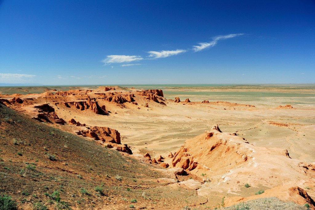
This desert lies to the southwest of the Taimur highlands. Here there is almost no silver, creating an arid region. The little water that rains down sinks into the ground down to several tens of meters deep. Most gold is in the south, making that a warm to hot desert, while the northeast near Taimur is cold. This frequently creates fierce winds which equalize the temperature differences and raise violent dust storms. The Tuarantu desert is a little under 250,000 km² in size.
People
The Tuarantu desert is home to some 9,000 people. Telgu dominate the warmer south, while tarhar are more numerous in the north. Unlike most regions on Yen, simi are rare here. Most people live around the oases. As the Tuarantu desert has nog long aquifers like some deserts on Earth, just a handful of places where the shortage of silver is less severe, these are more rare than on Earth.
Settlements
The only permanent settlements in the Tuarantu desert are oasis villages. Most are just hamlets, none is larger than a village.
Culture
The people of the desert live a harsh life.
Their material possessions are few and always functional, yet they express their art in them.
Almost every tent, saddle, kitchen pan, piece of clothing or other object is brightened by decorations.
Desert nomads are culturally obliged to help each other in times of distress.
This command extends into hospitality and sharing water and food when supplies run low.
No payment is required for this help, except to return the favor if the situation becomes reversed.
However, the tradition requires that everybody takes care of themselves as much as possible.
Strangers who wander into the desert unprepared for the environment are left to their own devices.
Politics
The oasis villages are led by headmen, who have little power and are mostly first among equals. Telgu and tarhar live in harmony.
Economy
The desert yields little, but what it yields is precious. Salt is mined in several places, coveted all over Yen. Carmine can be harvested from cochineal on cacti. In the south edge conditions are right for date palms.
Wirrah swamp
Description
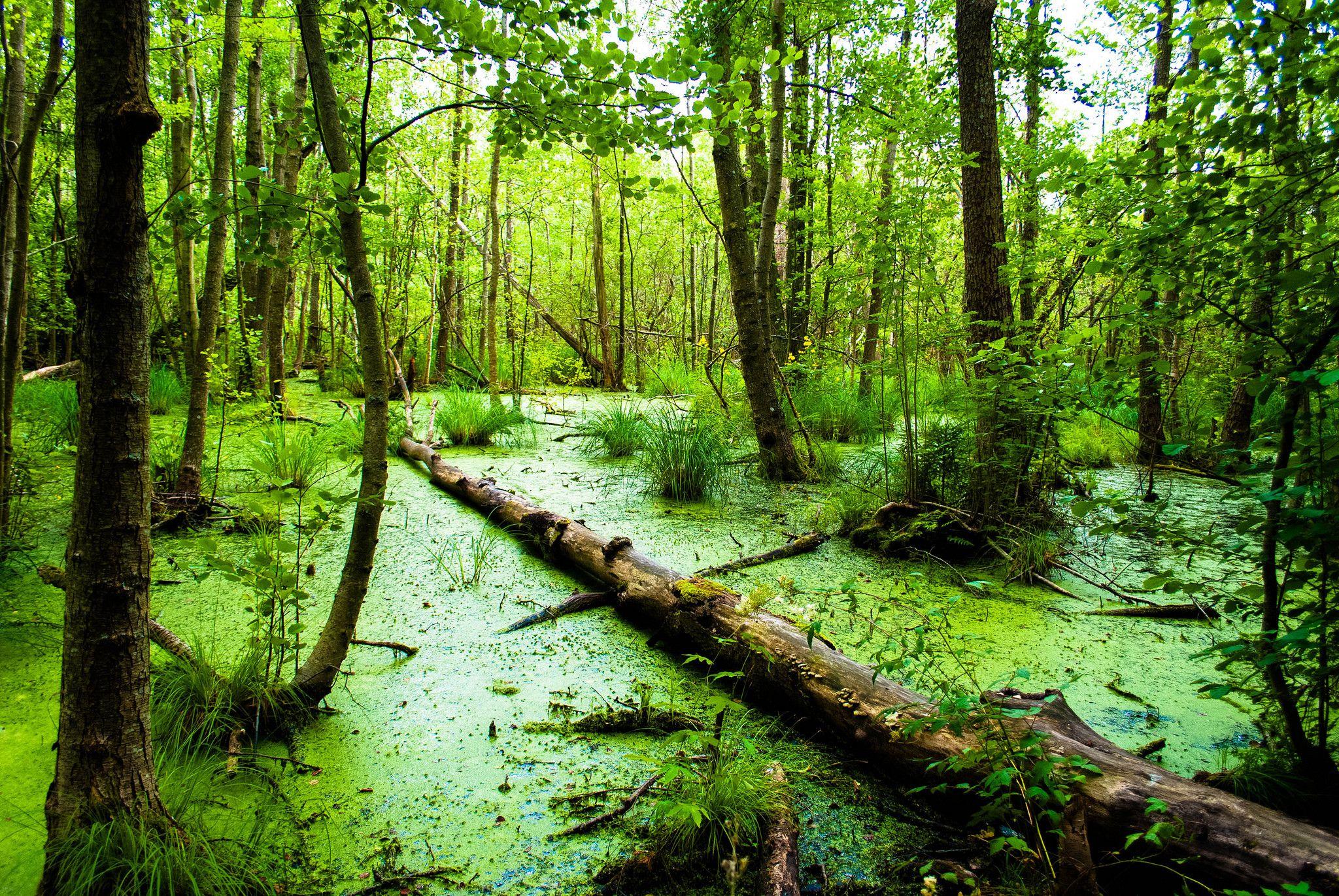
This large swamp in the west occupies the whole lower valley of the large fork-tongued Oktanin river.
It is a lowland area, a labyrinth of large and small waterways, forest, ponds and quicksand.
Some have fresh water, some salt, others brackish.
Like in the neighboring Tehclaltho jungle, gold is plentiful and the temperature high, and silver even more abundant, making it a true wetland area.
The Oktanin river originates in the Tlallii highlands and flows east into the Egyrr, forking halfway into the North Oktanin and South Oktanin.
It supplies the swamp, already wet from silver, with a lot of extra water.
People
The swamp has given rise to a colony of plants that form a single organism, Ordh'inagei, which rules it.
Economy
This swamp, ruled by Ordh'inagei, is fully self-sufficient. Here there is no growing of food, no industry, no trade.
Yamato
Description
Yamato ('Great Harmony') is a group of islands at the eastern side of Yen, a mix of raw forest and cultivated woodland. Their surface area is about 90,000 km². Under it lie some very strong earth flows, which have pushed a mountain range up out of the sea. There is enough gold to raise temperatures to above average and silver to pull in plenty of rain. Wind and rain rolling in from the Umi break on the mountains and create many rivers that flood the plains below. This creates fertile soil that feeds many simi, who originally hail from the island. Despite its position at the edge of Yen, Yamato, as the birthplace of the enterprising simi race, has a rich culture that continues to influence many other peoples. Go, the ancient language of the Yamato people, has become a kind of lingua franca on the continent.
People
The islands are home to some 1 million simi. Most of them live in the plains, a few in the mountains. The high density of people has forced them to develop a strict social system that they call "wa", 'harmony'. This stresses a calm demeanor, cleanliness, respect for those of higher station, greeting properly, bowing, and more. However, the varied topography keeps the island from political unification most of the time and its inhabitants fight many wars.
Settlements
The ancient capital of Yamato, Kaseyama, seat of the emperor and his court, lies right at the center of the island. It is a city of some 20,000 people, full of temples and palaces built by a long line of emperors.
Culture
In some places in Yamato the density of people is quite high.
This prompted them to develop a strict social system that they call "wa", 'harmony'.
It stresses a calm demeanor, cleanliness, respect for superiors, bowing and much more.
Literacy among the simi of Yamato is high.
Reading, writing and also storytelling and podium plays are favorite pastimes.
There are several genres like comedy, tragedy and romance.
Wordplay is very important and the Go language, with its inflections and conjugations, allows for many ambiguous lines.
"Ikasumi", the art of hiding multiple messages in a single piece of text, often poetry, can reach great heights.
Almost all the people of Yamato adhere to kodō, the traditional religion.
For them wa extends beyond the simi themselves and applies to nature too.
Politics
The wa culture does not guarantee a peaceful society.
The island is divided into provinces, each with its own clan.
These always try to extend their influence and are in constant conflict with each other.
There is an emperor (or empress) who rules over all Yamato simi, but his power is limited, usually to his home province only.
The position of the emperor is not hereditary, a new is elected after the death of the previous one.
Though the real power of the emperor is small, the position is prestigious and subject to much scheming, wrangling and fighting.
Unlike the emperor, the position of clan leaders are hereditary.
A system of cognatic ultimogeniture is used, i.e. the youngest heir inherits, either male or female.
Often that youngster is too young to rule him/herself and for several years is second to a regent.
Many regents prove hard to dispose of once their job is done, which leads to much infighting.
Economy
Yamato is Yen's greatest exporter of tea, which flourishes in the fertile soil and wet climate. Other raw material resources include sandstone, agate and silk and dyes like indigo. The dense population and highly developed society on Yamato includes many craftsmen. These produce goods like clothing, lacquerware, glass, ceramics and some armor and weapons. The sea between Yamato and Kaigan is a source of coral, fish and pearls. The islanders are numerous but import little import food, growing a lot of rice on the island. Imports are luxury foods and beverages, spices and raw materials like marble. All trade is by ship, almost all of it to and from Kaigan, though some of it goes further north or south.
Yamazui
Description
Yamazui is the largest wetland on Yen, around 175,000 km² including the forest at the edges, laying between the South Yrgiz steppe and the Egyrr sea.
An abundance of silver draws in a lot of rain; temperature is above average but no so high as in neighboring Nkala.
It is mostly swamp, but large areas are low-lying marshes, fens and bogs.
Gold flows close to the surface, making the area warm and fertile.
The Hakare river, or river complex, is a network of streams that flows westward through Yamazui, draining part of its waters into the Egyrr.
Along the way it touches several large and many smaller lakes.
It flows slowly.
Many branches split off and rejoin at other points.
The river is broad but shallow and can be navigated only by flatbottom boats.
People
Many species make Yamazui their home.
The simi are the dominant sapient species, but have been unable to establish their customary stone cities.
Instead, they live on large floating rafts that are as much garden as housing area and where waterways are as common as walkways.
The total population is maybe 5 million people.
In several areas there is a lot of agriculture, often using "mibun", which resemble Earth Aztec chinampas.
These make heavy use of irrigation and soil replenishment, and have large yields, feeding many people.
Settlements
The largest city in Yamazui is named Bō.
It is entirely built of wood, raised above the swamp below by countless sturdy poles.
It is located in the center of the region, at the point where the river Hakare flows out of Yamazui lake.
The second-largest city in Yamazui is Seidaito, one of the largest port cities of Yen,
located in the far north of the region, at near the mouth of the Oromosh river.
Its harbor is always in danger of silting, but the city employs a permanent army of slave divers to keep the fairways open.
Fushi is the original seat of the former Ring of Eight magocracy, still the major center for study of magic on Yen.
It is located in the north of the swamp.
In the south, on the right bank of the southern course of the Hakare river, lies Ido.
This is the original holy town of ugokuchi.
Bō has taken over as de facto religious capital, but Ido is still important.
At times when the emperor and high priest fall out with each other, the latter usually retreats to Ido.
Culture
The simi of Yamazui are a proud people.
The region surpasses all others in population, industry and power, and they know it.
Many consider Yamato and even Kaigan as old relics, surpassed by the wetlands.
All young simi in Yamazui, regardless of class, are taught how to swim, how to grow food and how to fight.
The region boasts its own religion, ugokuchi, which is unpopular everywhere else, especially in the north of Yamazui itself, where nairukyō is dominant.
The city of Bō is the ugokuchi center, housing a massive pyramid where blood sacrifices are made every day.
All simi in Yamazui learn to swim and navigate boats at a young age.
Besides swimming and boating, they also walk the swamp on stilts.
Stilt-running is a national sport.
Politics
Like many regions on Yen, Yamazui is filled with city states.
Unlike most regions, they are frequently welded together into kingdoms or even an empire.
Dominant across many centuries is Kumo Tei, the Spider Empire, centered on the city of Bō.
Fortune and misfortune have made it wax and wane, but it is always a major power factor.
Kumo Tei dominates other states but its rule is very indirect, treating them like vassals instead of integrated provinces.
They are required to pay tribute, in goods, money and sacrifices for the ugokuchi temples.
Power in the empire lies with the emperor and the high priest.
Often there is a power struggle between the two, and at several times the empire has split apart along this power axis.
Since the Age of Magic the mages of Fushi also play a part in the intrigue, making Yamazui politics even more complicated.
Economy
The vast Yamazui swamp yields many varieties of fruits and sweetwater fish. The port of Bō produces a lot of coral, pearls and sponges. Yamazui is the main center of ceramics on Yen, exporting high quality pottery, terracotta, porcelain and other ceramics all over the world. Also, it is the source of jute, cotton and papyrus. The region imports mostly salt, spices, stone and metals from the Siir mountains to the north and other goods from the east. Traders laboriously navigate the swamp's streams in flat-bottomed boats. Many people in Yamazui feed on the equivalent of the Three Sisters: maize, beans and squash, which are grown in small but numerous fields that are watered and fertilized by the swamp. Tomatoes and peanuts too are popular crops. At the edges of the region soybeans are grown.
Yarega
Description
This peninsula lies to the west of the Taimur highland. It encompasses an area of 40,000 km². It is a mountainous region, carved up by deep fjords, though the slopes have eroded away somewhat. The south is relatively open, while the north is covered in a mix boreal and broadleaf forest. Unlike neighboring Taimur and the Tuarantu desert it is a fertile region. Gold distribution is uneven, enough for average temperatures in the south and below average in the north; silver and rainfall are average. Some of the richest metal mines on Yen are found in this region, making it second only to the Siir.
People
In Yarega a mixed population of 350,000 simi, tarhar and thref make their home.
Settlements
The capital of Yarega is Medgord, the Copper Town, in the south on the north end of the Pobed bay. Its name derives from the abundant use of copper for the roofs of the houses. The town is home to the Academy of Svetl, where sages dig into the mysteries of science. All magic is strictly forbidden here, on the penalty of death, so as not to disturb the 'reality' of the natural world.
Culture
Yarega is a distinct region, set apart from the rest by Taimur and the Tuaranta desert.
Together with the Narkush mountains, it is the only place where thref mix with other races.
The region is the home of the Vesemei religion.
Most people honor the gods and try to obtain favors from them, but a substantial minority try to become gods themselves.
Craft guilds, scientists at the academy and even common farmers try come up with the next 'change' for Yen.
This progressive mood is common throughout Yarega.
The people consider themselves something of an elite and are mistrustful of outsiders.
Mages especially are shunned and sometimes even hunted.
Politics
Yarega is divided into 'patches' areas ruled by a chieftain. These range from large in the north to petty kingdoms in the more densely populated south. Most areas have a mix of simi, tarhar and thref; there are no racial boundaries. Warfare among these is frequent but low intensity, small raids.
Economy
Yarega is the main producer of copper and malachite on Yen.
There are roughly three main trade routes to and from the peninsula:
- The Icy Way: From Yarega over the ice fields of Taimur to Shihoshi
- The Dry Way: A short hop from Yarega over the sea, to Tuarantu, then through the desert to Hashi
- The Wet Way: The longest route, from Yarega over the seas, hugging the coast, to Iihhne and Techlaltho
None of these routes are paved. Because trading is so difficult for Yarega, the region is largely self-sufficient. Its stable crops are wheat and rice, supplemented by fish.
Yrgiz steppe
Description
The Yrgiz occupies almost all the entire eastern flank of Yen.
It is split between a north and a south part, with the Hurannar highlands and the Hesha valley wedged in between.
The total area of both Yrgiz steppes combined is about 180,000 km².
Overall the temperature is average, with local variations, while rainfall is modest everywhere on the steppe.
Limited rainfall prevents trees from colonizing the area; instead it is dominated by grass and shrub.
Along the edges the grassland passes into woodland.
The great Oromosh river flows from Narkush mountains, through the northern steppe, swings pas the Siir, past the great city of Heshajey, through the southern steppe
and through north Yamazui before finally flushing into the Egyrr through its vast delta.
More than half of this waterway is navigable by ships, and it is a lifeline for a whole string of civilizations.
People
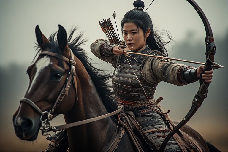
Some 100,000 - 150,000 nomads are estimated to roam here.
They are all hardy tarhar nomads.
Many of them ride horses, relying on speed and maneuverability in warfare.
They frequently raid the surroundings lands, though they do not penetrate deep into forests or swamps.
The Northern Yrgiz steppe is dominated by the Dişirlik, a confederacy of tribes where females are dominant over males.
In the Southern steppe it is the other way around, with the males in charge.
Armies of north and south fight each other as much as they fight foreigners.
More peaceful are the Maziq nomads, who ride geygir.
They use them as cattle but mostly also as mobile homes.
Each tame adult geygir carries a "kizuy", the traditional rickety Maziq portable tent, made of wood, bones and leather.
One kizuy houses a full Maziq family.
Herds of geygir and Maziq slowly crisscross the plains, moving among fertile areas.
Settlements
The largest city of the tarhar steppe nomads is Genishorda.
It lies near the north edge of the Southern Yrgiz steppe.
It is not really a city but a small town with only some 1,000 inhabitants.
But during winter, when nomads from all over the steppe converge here, this number swells to 5,000 or more.
Then the wide open spaces inside its low outer walls are filled with yurts, horses and livestock, with life and noise,
all to disappear again after a few months.
Much larger and much more cosmopolitan is the city of Heshajey,
which lies in the center of the fertile Hesha valley, between Siir, the Yrgiz steppes and Yamazui, straddling the lower Oromosh river.
The valley is surrounded by hills, inhabited by fierce simi tribes, who all covet the riches of the plains.
The city has been conquered many times, often by tribes from the plains.
Next to the two cities there are many caravansaries, most no larger than a single fort, where travellers can seek refuge from wandering bandits.
Culture
The people of the steppe are nomads through and through.
They do not live in houses, but in "ordu", groups of tents, which they move whenever the need arises, or it is their desire to do so.
They take huge pride in their freedom and vigor and regard sedentary people with contempt.
Many times the nomads have raided and even conquered towns and cities at the edges of the steppes,
but even there they often maintain their steppe traditions, putting down tents among city walls rather than living in the houses.
Their great capital Genishorda is just that: a large seasonal tent gathering.
Herding is the lifeline for the nomads.
They are expert animal handlers and appraisers and go where their herds need to go.
They consume mostly dairy products and meat, spiced with spices acquired through trade.
Like the Earth peoples of Central Asia, the Yrgiz nomads herd goats, sheep, cattle, horses and camels.
Yrgiz sports reflect their nomadic life: horse racing, horse archery, horse acrobatics.
Even "pakpar", all ball game, is performed mounted.
In war, the nomads field mostly horse archers, nimble and fast, able to shoot from horseback in varying positions.
For combat at closer ranges they wield spears and curved swords, or hand axes and maces.
Such mounted melee combat is rare, taking place when an enemy is almost defeated by missile fire.
Most horsemen are lightly armored, but a small number wear heavier armor and act as shock troops.
Most Yrgiz nomads stick to the old steppe religion, Tangre, though some are influenced by foreign religions like nairukyō or ugokuchi.
In the Hesha valley (see below) taka-nairukyō is the main religion, though there are also many followers of ju-nairukyō.
Politics
The Yrgiz nomads are organized in tribes, roaming the steppes.
Each is headed by a khan or khanum, a strong warlord.
In the north its is the women whoe rule, in the south the men.
The nomads have a system of primogeniture: when the khan/khanum dies, the eldest son/daughter takes over.
This is not a strict rule, as sometimes a younger sibling gains more favor or there is so much disagreement that the tribe splits in two.
Life on the steppes is hard.
Good living depends on good grazing grounds, which in turn depend on the variable appearance of silver.
Nomad tribes frequently battle over these pastures, and raid each other's cattle.
Tribes who cannot hold their own can dissolve quickly, their members joining other, more successful tribes.
So power on the steppes is very fluid.
Some tribes may rise to great heights and dominate their neighbors, but this never lasts very long.
The city of Heshajey is an anomaly on the Yrgiz steppes.
It is urban, not pastoral; situated in woodland, not grassland; watered all year round by a river rather than intermittedly by silver.
It has been conquered so many times that its inhabitants have given up of defending it at all.
Instead, they absorb all newcomers, who find that though conquest is easy, maintaining a hold on power in Heshajey is much more difficult.
The population is divided into factions that can be played against other, but sooner or later will turn on the ruling faction.
Ever present are Red Rats, a guild of professional assassins who have elevated killing almost into an art and are hired by everybody to murder their enemies.
So fierce is the competition that more people die every year assassination than from disease, but the wealth of the city always attracts newcomers who want to try their luck.
Economy
The nomads of the Yrgiz steppes maintain large herds of horses, cattle, sheep, goats and geygir.
Because of their meat-rich diet they have little need of salt but still import it from the Siir to salt excess meat, which is then exported.
They also export leather, wool and furs.
Milk and horses are used by themselves.
Other imports consist of luxury items and weaponry.
Much of the trade of the eastern half of Yen flows through the steppes, where the steeds and wagons of the nomads provide fast transport with high capacity,
at the price of significant fees.
The Hesha valley is more diverse, producing cotton and sunflower seeds.
Heshajey is famous for its elaborate carpets.